LOCATION DETAILS
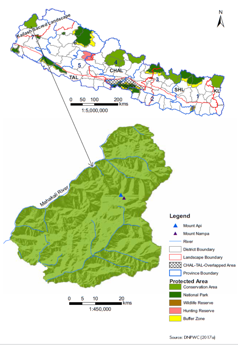
The Api-Nampa Conservation Area is a protected area in the Far-Western Development Region, Nepal. The western boundary is formed by the Mahakali River, and the northern by the international border with Tibet. Adjacent to the east are the Bajhang and Baitadi districts. It ranges in elevation from 518 to 7,132 m (1,699 to 23,399 ft) at the Himalayan peak Api, and is within the circumscribed area of the Kailash Sacred Landscape.
Moreover the following map demonstrates the location of the ANCA with all the necessary informations.